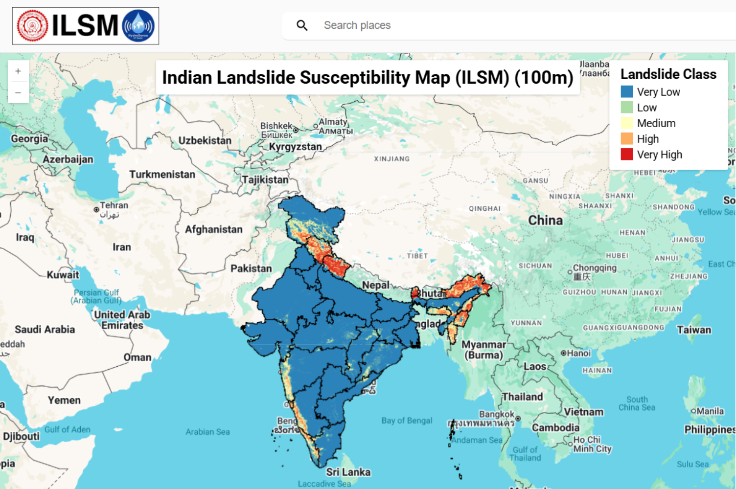
India’s first machine learning–based landslide susceptibility map, delivering probabilistic risk estimates at 100 m resolution across the entire country.
National-scale landslide risk intelligence
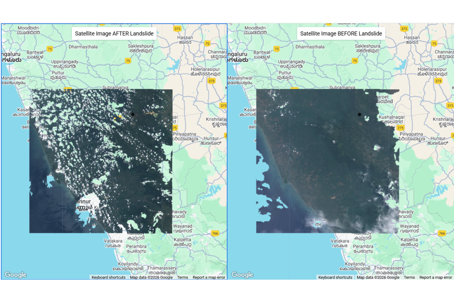
A real-time, open-source system for fast and accurate landslide mapping using Sentinel-2 imagery and minimal user input.
Rapid landslide extent mapping in minutes
A fully automated SAR-based flood inundation mapping system, delivering high-accuracy results even under clouds, vegetation, and nighttime conditions.
All-weather, real-time flood mapping with uncertainty

.png)
.png)
.png)
.png)
EarthSense Labs delivers asset-level geospatial intelligence at planetary scale, powered by science-informed AI and 4D digital twins.