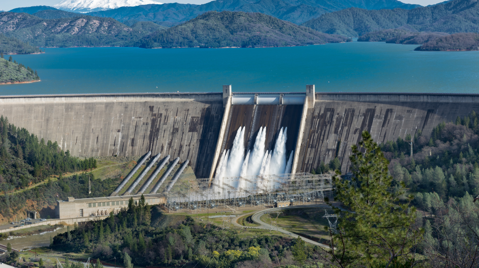
A real-time digital twin that fuses hydrology, terrain, and infrastructure data to optimize reservoir operations and manage risk.
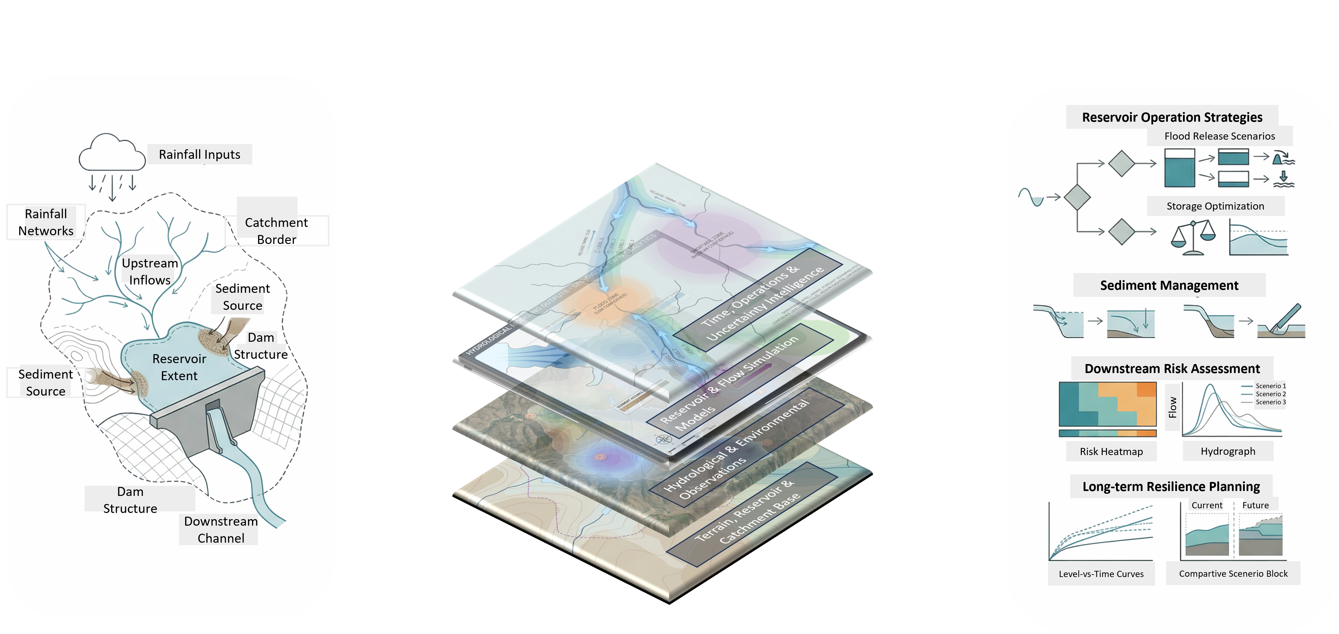
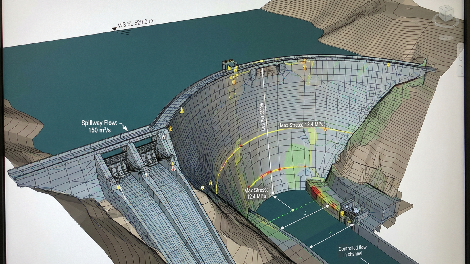
We establish a precise digital foundation of your dam and reservoir ecosystem — integrating satellite data, terrain models, hydrology records, and sensor telemetry to ensure your system is ready for intelligent decision-making.
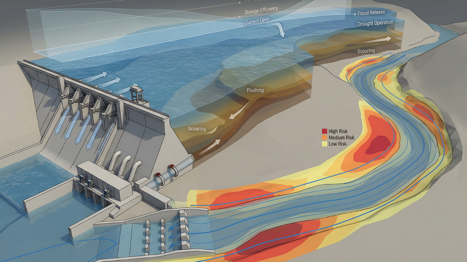
With the digital twin in place, GeoTwin continuously analyzes inflows, rainfall, soil moisture, sedimentation, and asset health — enabling predictive forecasting, safe reservoir operations, and early-warning alerts before issues escalate.
We finalize with automated reports, operational recommendations, and actionable dashboards. You gain a fully optimized water system — delivering higher safety, reduced risk, and improved storage efficiency for the future.
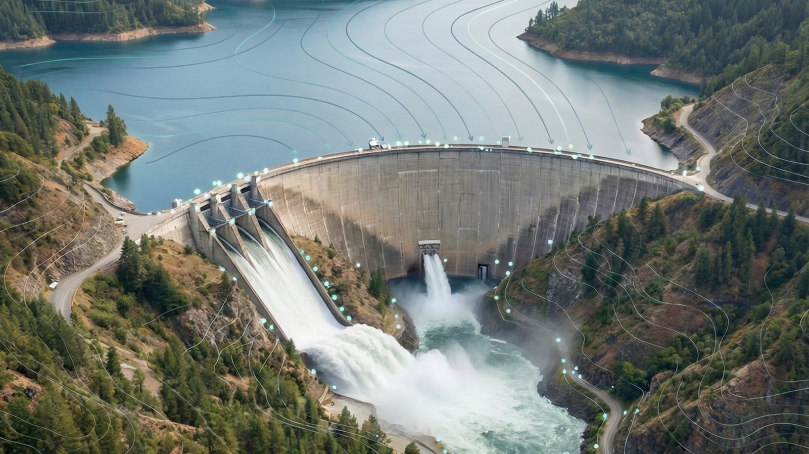
Managing dams and reservoirs has never been more complex. Changing rainfall patterns, sediment buildup, and aging infrastructure make every decision critical. Traditional systems react after the fact — when it’s already too late.
We establish a precise digital foundation of your dam and reservoir ecosystem — integrating satellite data, terrain models, hydrology records, and sensor telemetry to ensure your system is ready for intelligent decision-making.
With the digital twin in place, GeoTwin continuously analyzes inflows, rainfall, soil moisture, sedimentation, and asset health — enabling predictive forecasting, safe reservoir operations, and early-warning alerts before issues escalate.
We finalize with automated reports, operational recommendations, and actionable dashboards. You gain a fully optimized water system — delivering higher safety, reduced risk, and improved storage efficiency for the future.

GeoTwin doesn’t just visualize your water systems it optimizes them. By combining terrain analytics, hydrological simulations
See how EarthSense GeoTwin transforms data into foresight for water resilience and operational excellence.
.png)
.png)
.png)
.png)
EarthSense Labs delivers asset-level geospatial intelligence at planetary scale, powered by science-informed AI and 4D digital twins.