A real-time digital twin that integrates urban infrastructure, mobility, and environmental data to help cities plan, monitor, and optimize operations.
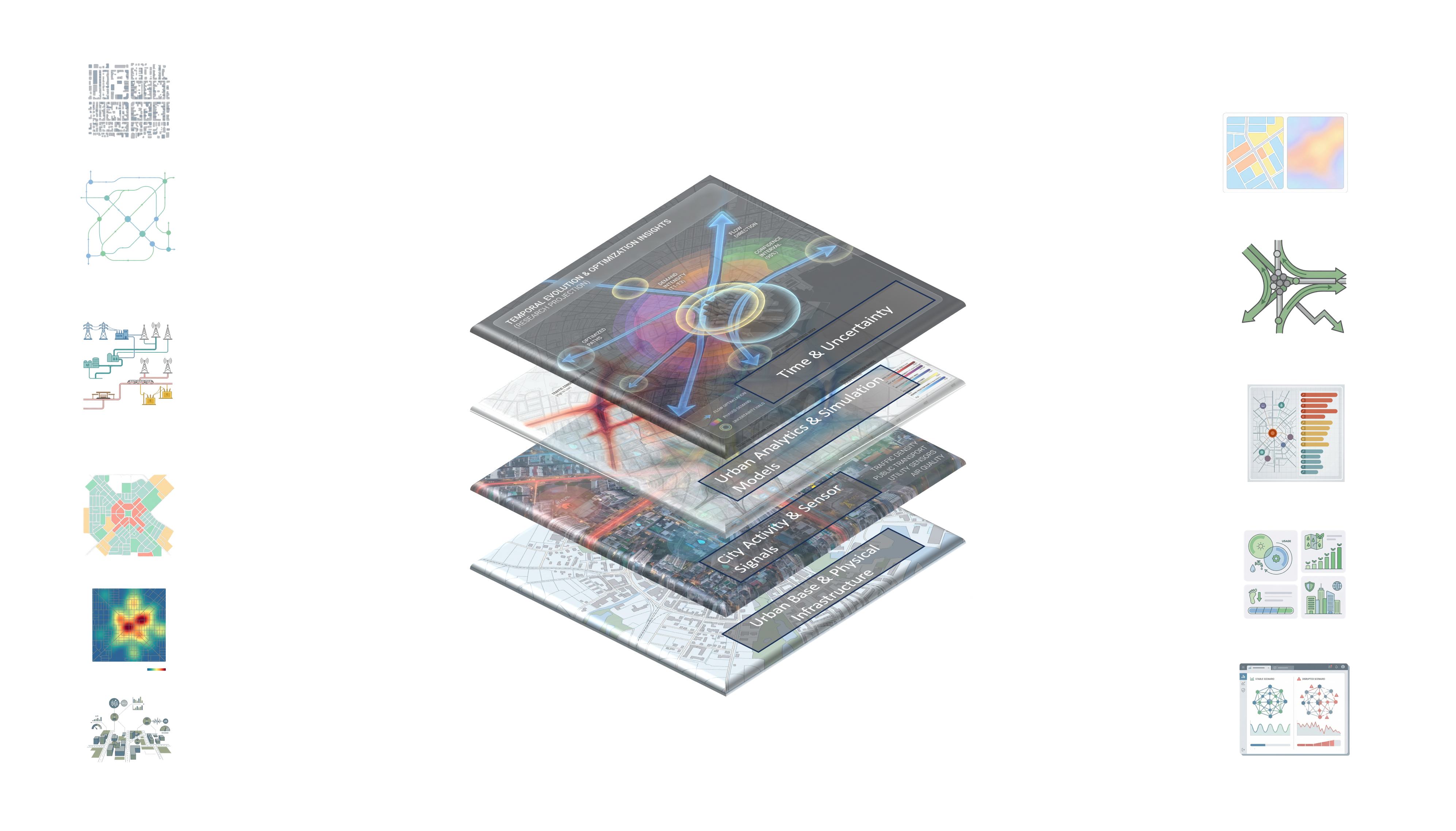
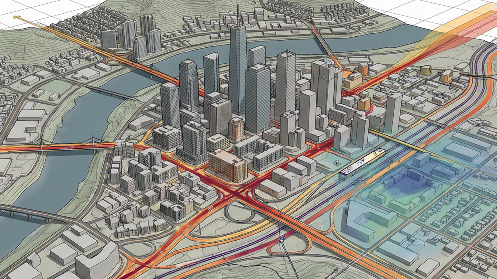
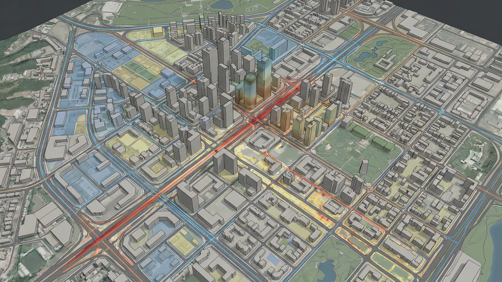
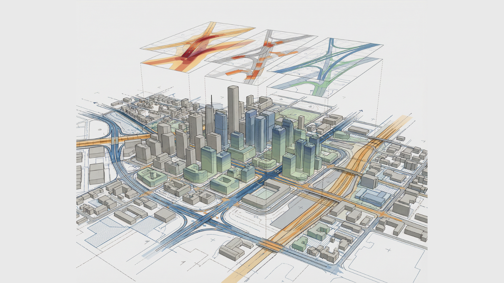
We begin by creating a unified digital foundation of your urban environment — integrating building footprints, traffic networks, public assets, and environmental data to deliver a true, living model of the city in real time.
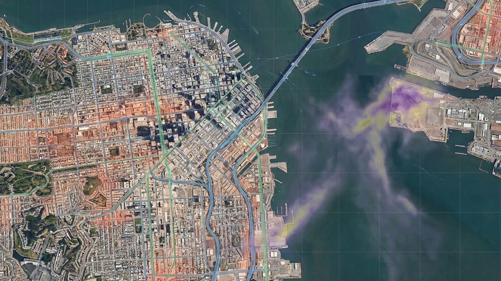
With the GeoTwin established, we continuously track traffic flow, air quality, energy usage, and infrastructure stress. AI-driven forecasting enables early detection of inefficiencies, helping city planners act before small problems become major disruptions.
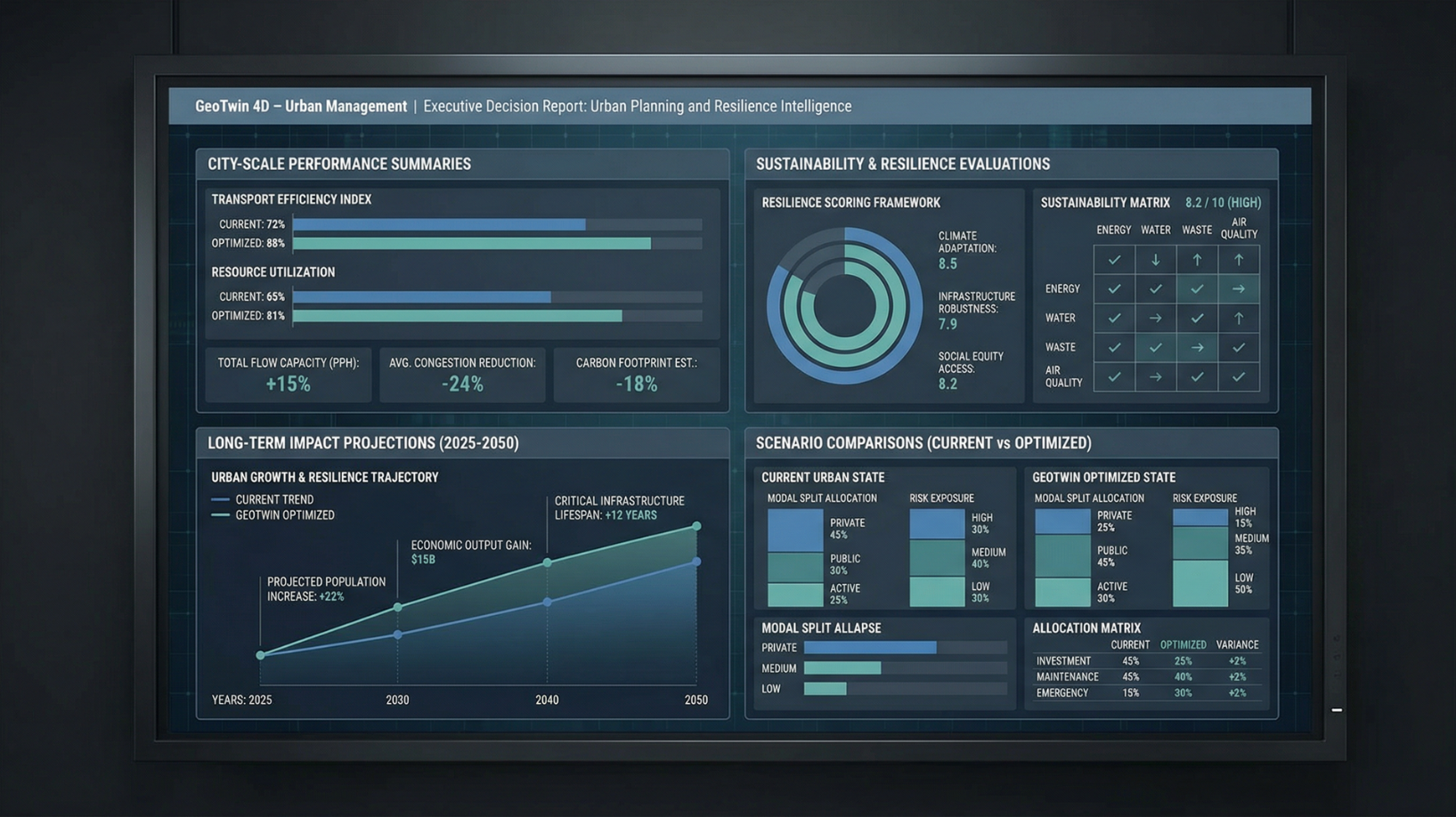
We close the loop with actionable intelligence dashboards, scenario simulations, and sustainability analytics — empowering cities to operate efficiently, reduce emissions, and improve the quality of urban life for every citizen.
We begin by creating a unified digital foundation of your urban environment — integrating building footprints, traffic networks, public assets, and environmental data to deliver a true, living model of the city in real time.
With the GeoTwin established, we continuously track traffic flow, air quality, energy usage, and infrastructure stress. AI-driven forecasting enables early detection of inefficiencies, helping city planners act before small problems become major disruptions.
We close the loop with actionable intelligence dashboards, scenario simulations, and sustainability analytics — empowering cities to operate efficiently, reduce emissions, and improve the quality of urban life for every citizen.
Cities today are living, breathing ecosystems — but their data is often disconnected. Rapid urbanization, climate change, and infrastructure strain demand real-time insight and coordination that traditional systems can’t deliver.
GeoTwin converts complex city data into actionable intelligence, empowering planners and policymakers to make faster, data-driven decisions that enhance sustainability, safety, and citizen well-being.
See how EarthSense GeoTwin transforms data into foresight for water resilience and operational excellence.
.png)
.png)
.png)
.png)
EarthSense Labs delivers asset-level geospatial intelligence at planetary scale, powered by science-informed AI and 4D digital twins.