A unified 4D digital twin framework that integrates multi-source geospatial data, physics-aware modeling, and AI forecasting to enable early warning, risk assessment, and coordinated disaster response.
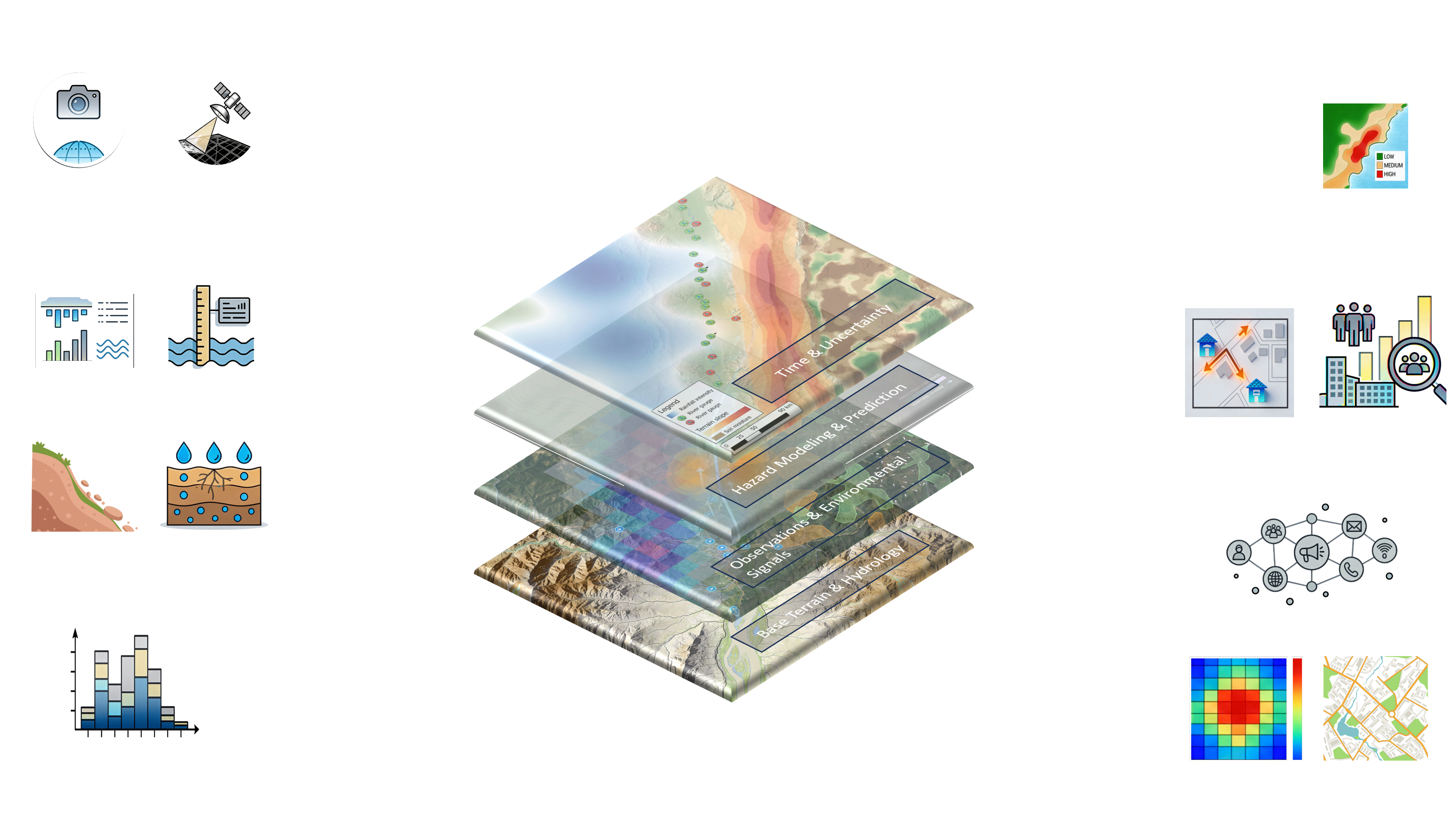
We start by mapping vulnerable regions through GeoTwin’s integrated terrain, climate, and infrastructure datasets — creating a real-time digital twin that highlights potential risk zones and response pathways before disasters strike.
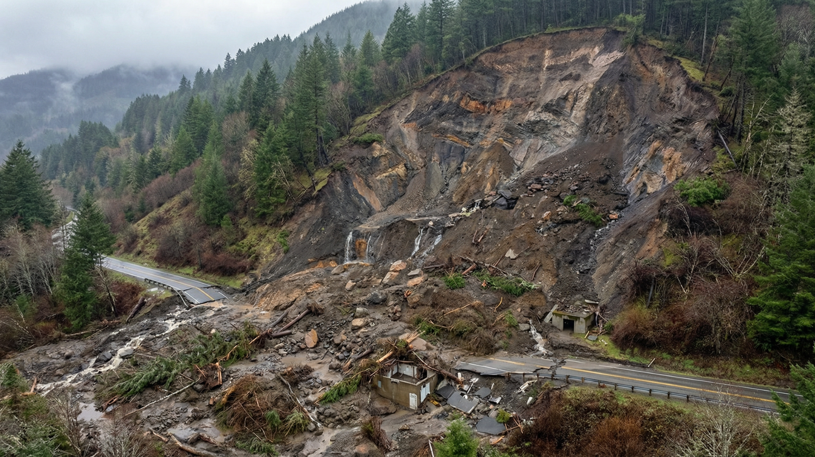
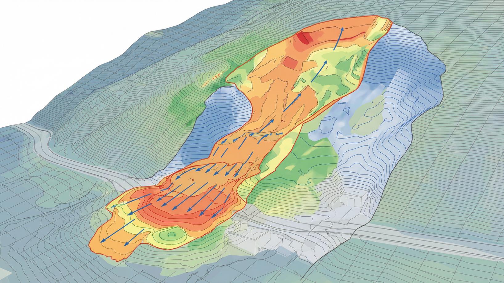
AI-driven forecasting models simulate floods, landslides, and seismic events to anticipate impact zones. Emergency teams receive live alerts, resource optimization plans, and predictive visualizations to act with speed and precision.
After the event, GeoTwin helps assess damage through satellite and sensor data, guiding rapid recovery and reconstruction. Continuous feedback ensures the system learns and strengthens preparedness for the next event.
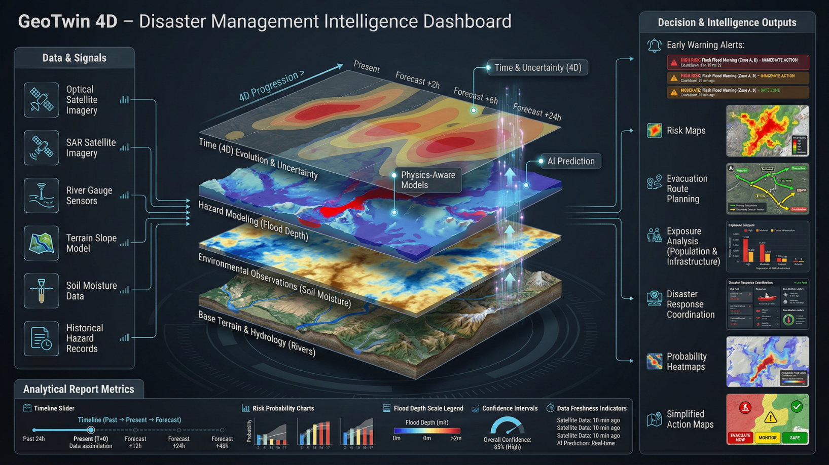
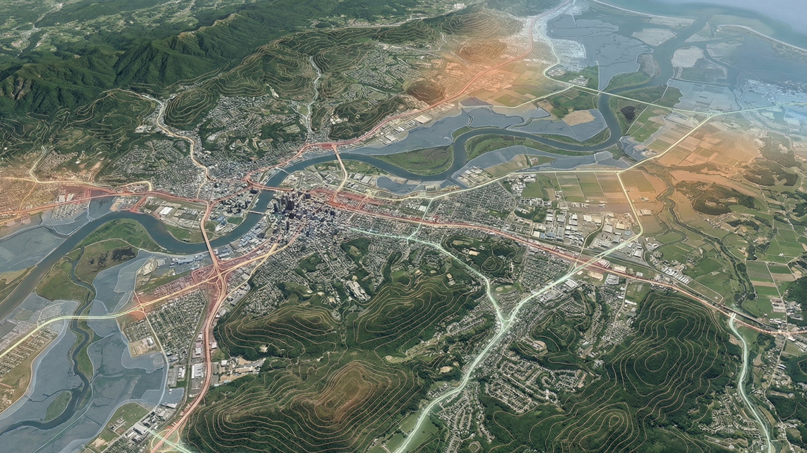
We start by mapping vulnerable regions through GeoTwin’s integrated terrain, climate, and infrastructure datasets — creating a real-time digital twin that highlights potential risk zones and response pathways before disasters strike.
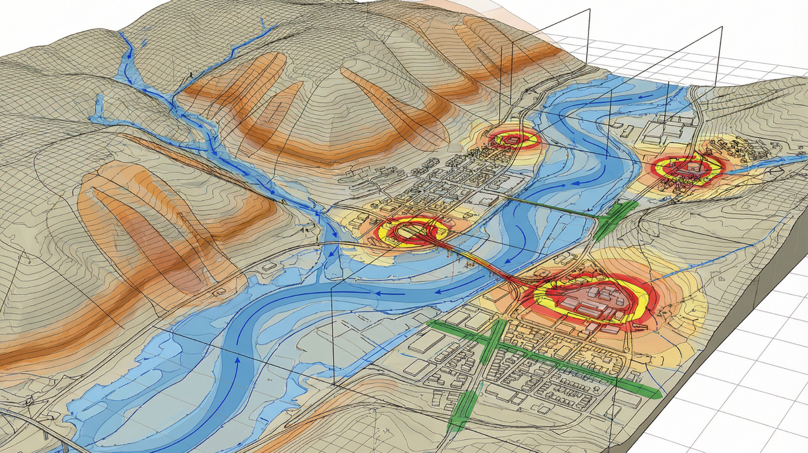
AI-driven forecasting models simulate floods, landslides, and seismic events to anticipate impact zones. Emergency teams receive live alerts, resource optimization plans, and predictive visualizations to act with speed and precision.
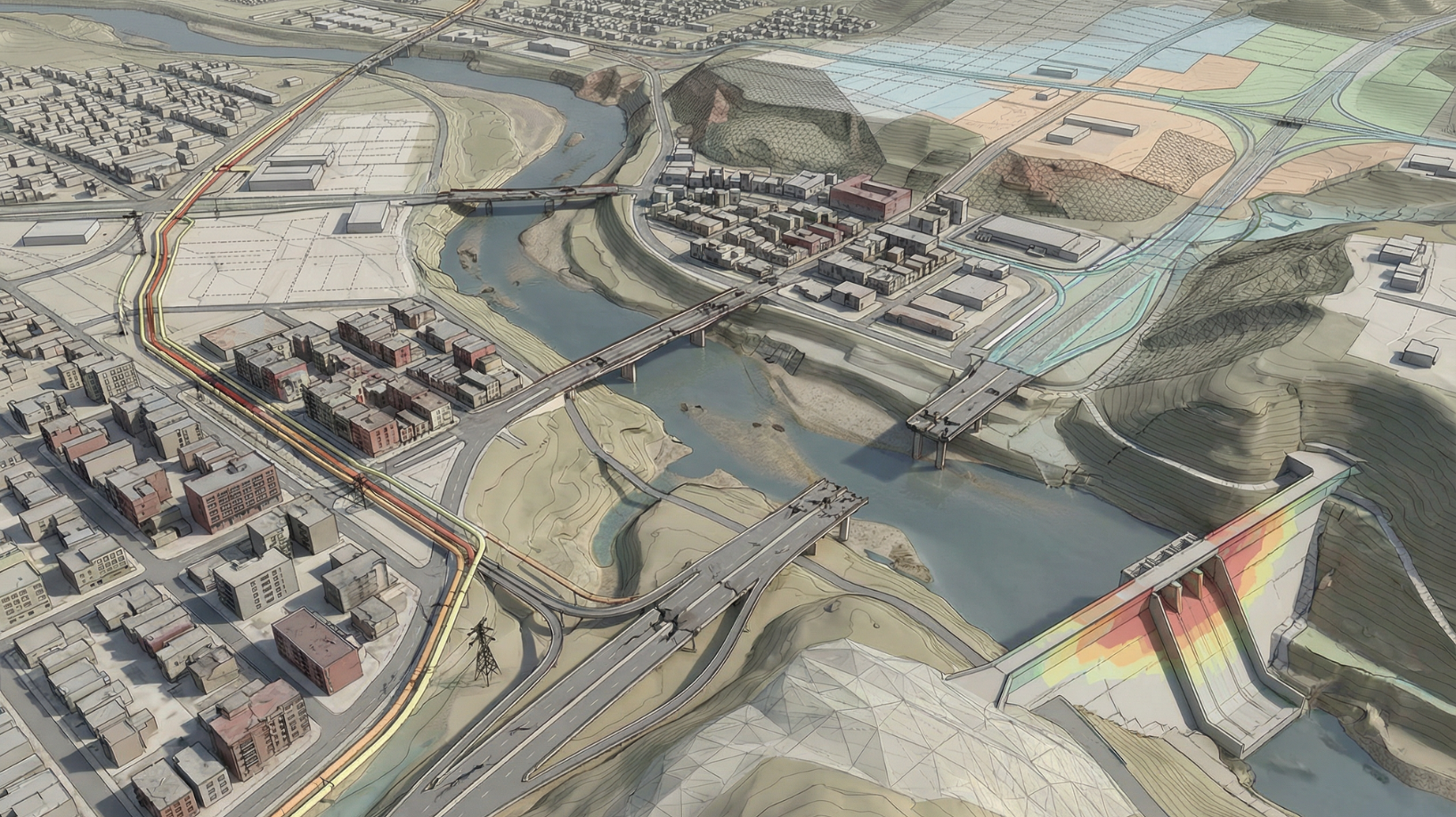
After the event, GeoTwin helps assess damage through satellite and sensor data, guiding rapid recovery and reconstruction. Continuous feedback ensures the system learns and strengthens preparedness for the next event.
Disaster events are becoming more frequent and unpredictable. Floods, landslides, and heatwaves push response systems to their limits. Traditional tools react only after damage occurs when it’s already too late.
GeoTwin doesn’t just visualize risk it strengthens systems against it. Turn reactive crisis management into proactive resilience planning powered by continuous intelligence.
See how EarthSense GeoTwin transforms data into foresight for water resilience and operational excellence.
.png)


